Tea Fire Remembered: Four Years Later Alert Systems Improving
Four years after the devastating Tea Fire, residents are seeing signs of improving alert systems that help in evacuations.
Chief Chip Hickman with the Montecito Fire Protection District says residents have many ways they can be contacted in an emergency including a reverse 911 call from the Sheriff's department, text messages, facebook notifications, a "Nixle" message (which delivers specific emergency information) and they can also buy a special device that sets off an alert tone in their home. The community also has a low power radio station 1610 am that delivers messages over the air. There are also now, pre set evacuation zones on a map to help fire crews prioritize the areas they need to focus on when an emergency takes place.
"Our first priority is to get people out of the way," said Hickman who was the first incident commander on the scene the night of the fire.
He called for an evacuation, along with help from the Sheriff's Department and Highway Patrol. Immediately after the fire broke out, additional resources from Santa Barbara City Fire, Santa Barbara County Fire and the Carpinteria-Summerland Fire Protection District were called in.
The disaster destroyed 210 homes, but fortunately no lives were lost. Montecito resident Abe Powell, a newly elected member of the Montecito Fire Protection District Board says residents are in a better place today than they were in 2008 when the Tea Fire broke out. "The community is much, much better and the plan for evacuation and protecting the community is much more evolved in the four years since the Tea Fire," said Powell.
The cause of the fire was never fully determined,despite an extensive investigation by arson officials. Charges of trespassing and illegally starting a camping fire were filed against a group of your people who were in the area where the flames first appeared, many hours earlier. Chief Hickman says many areas of the front country are still loaded with explosive fuels. Some of the canyons from the Rincon to Montecito haven't seen fire in 40 years. He says residents need to always be ready and especially on high alert when temperatures are high, humidity is low and winds are strong.
"We definitely still have a threat," said Hickman. For Powell, he tells residents, "you can not be too prepared and it's real easy to think it can't happen to you, but I am here to say it can."
KEY News Senior Reporter John Palminteri has the story in the video below...
35 wildfires burn in 10 statesVisit NBCNews.com for breaking news, world news, and news about the economy |
Idaho town emptied as state's worst wildfire nears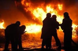
Thick smoke Sunday enveloped the town of Featherville, Idaho, where residents had evacuated as the state's worst wildfire in years approached.
The fire was approaching on two separate fronts and was expected to reach the mountain town about 50 miles east of Boise later Sunday. Authorities ordered an evacuation of the town Saturday, saying homes and businesses in the area were in "imminent danger." Firefighters were lighting backfires to clear out potential tinder for the advancing flames of what has been dubbed the Trinity Ridge fire. "It will not look the same in the next couple, three days as it looks today," incident commander Rick Harvey told residents at a public briefing. "We will do everything we can possibly do out there as firefighters to make sure that your community, the hills, the rivers are the same as (we) can." Suzanne Durant, 63, was preparing to leave the cabin where she has lived alone for years. She showed off an arrangement of fire prevention measures she had cobbled together as she said she was more than ready to get out of town. "This whole thing is surrounded by sprinklers," she said. The fire has been called the worst in Idaho in years — a not uncommon report for what has been a brutal Western wildfire season. About 5 million acres are destroyed in the average Western fire season, federal data show, but 6.4 million acres have already been consumed this year, with several weeks to go. Idaho firefighters have already used 1.2 million gallons of fire retardant this year, the most in at least 11 years, federal officials said. Meanwhile, fire officials said a wildfire in northern California has consumed nearly 11 square miles near the towns of Minton, Shingleton and Viola. A state fire spokesman said 3,500 homes across the rural area along the border of Tehama and Shasta counties are threatened. The cause of fire has not been determined, but officials say it started after lightning strikes in the area. |
Bleak Future for Firefighting C-130 Tankers
On-board spray system is no longer made and spare parts are unavailable.

CHEYENNE, Wyo. (AP) — The demise of the only company that manufactured a device specially designed to spray fire retardant from the back of U.S. military C-130 cargo planes has some experts worried about the future viability of a program that has helped fight wildfires for 40 years.
The Modular Airborne Firefighting System is a bus-sized device that can be shoved into the belly of a cargo plane and then used to spray retardant, or slurry, at 3,000 gallons in less than 5 seconds. The $4.9 million device's only manufacturer, Sacramento, Calif.-based Aero Union, went out of business in August, and no other company has replaced it. Critical spare parts also are no longer being made.
The MAFFS C130s are operated by three National Guard and one reserve unit in Wyoming, Colorado, North Carolina and California. Wyoming's MAFFS have been deployed as far away as Indonesia. Last year, MAFFS C-130s flew to wildfires in Arizona, New Mexico, Texas, Oregon and Mexico. They've been critical again this year against wildfires in Colorado, Montana, Wyoming and South Dakota.
"Thank God we have them. Can you imagine if we didn't have them?" said Tony Morris with the Wildfire Research Network, a Pacific Palisades, Calif., group that advocates for improved means to fight wildfires.
"At what point can we maintain control, or at what point do these fires burn out of control?"
Aero Union closed after the U.S. Forest Service canceled a contract worth a guaranteed minimum $14.5 million a year for firefighting services by six P-3 Orion air tankers. The Forest Service said Aero Union wasn't keeping up with inspections for those planes.
Aero Union is contesting the revocation in federal administrative court. Dallas-based Comerica bank foreclosed on Aero Union and offered the MAFFS-related assets at auction last winter. They failed to sell.
A bank spokesman declined to discuss any plans for those assets.
The Forest Service has stockpiled enough major parts, can source many smaller parts, and can mend the biggest parts no longer being made to keep the system running, said Scott Fisher, MAFFS coordinator for the Forest Service.
"The system was built for at least 20 years," he said. "I would not be surprised to see this thing fly for a full 30 years."
Eight of the planes were flying until a North Carolina Air National Guard C130 crashed in South Dakota on July 1, the first major accident in MAFFS program history. The crash killed four of six crew members and was still being investigated.
Forest Service officials said it was too soon to say if the MAFFS device on board, or any portion of it, might be salvageable.
"They can probably patch them up. But I think there may still be some issues on the unit itself where they may need an engineering team to get in there and work out any bugs," said Mike Archer, a wildfire consultant in Glendora, Calif.
The loss of technical help, especially, could prove troublesome while the Forest Service works out bugs in the latest-generation MAFFS II system in use since last year, he suggested.
"They haven't really used them enough, I don't think, to find out some of the problems," Archer said of the Forest Service and its workers contracted to maintain the MAFFS.
Forest Service officials insist the system is and will remain viable for years to come.
Meanwhile, the Forest Service has contracted technicians in California, Wyoming and Idaho to maintain the MAFFS. An in-house engineer at the National Interagency Fire Center in Boise, Idaho, can help troubleshoot any bugs, Fisher said.
"In any new system you're going to have some issues come up, and we've been able to work through them," Fisher said.
Aero Union's last chief executive, Britt Gourley of Seattle, declined to comment on the system's continued viability.
"I may have my personal opinions, but I keep them to myself. I don't know. I wish the Forest Service well and wish all the folks involved well," Gourley said.
Colorado wildfire: More pre-evacuation notices sent for High Park fire near Fort Collins
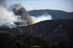
Pre-evacuation notices were sent Tuesday morning to an additional 95 contacts in the Rustic area of the High Park fire northwest outside Fort Collins, the Larimer County Sheriff reports.
The area is Colorado 14 from the Pingree Park Road west to approximately mile marker 90, just west of the Glen Echo Resort.
"We're not asking people to leave but simply be ready to leave at a moment's notice if fire conditions warrant that," sheriff's spokesman John Schulz said at a Tuesday morning news briefing.
The 59,500-acre High Park fire, the most destructive in the state's history in terms of homes destroyed at 189 , has been burning since June 9 when it was started by lightning. It is 50 percent contained and so far has cost $14.7 million.
Linda Steadman, 62, died in the fire at her home on 9123 Old Flowers Road.
Incident command spokesman Bill Hahnenberg said Tuesday that there are 1,800 firefighters working the blaze, which now has 49 miles of constructed and contained fire lines. The top priority of crews is "making sure the fire doesn't ... threaten homes," he said. "Another hot and dry day can be expected with very high to extreme fire danger," the National Weather Service warns. "The wild card is the wind," Hahnenberg said.
The high temperature Tuesday in the fire zone should be about 88 degrees. Hahnenberg estimated the humidity in the area will be in the 3-8 percent range. The local forecast calls for winds gusting up to 30 mph in spots. Hahnenberg said the winds won't be "hard out of the west, like Sunday. It will be more like yesterday, where we were pretty sucessful."
The most recent pre-evacuation zone is directly south of the Shambhala Mountain Center, where the largest Buddhist Center exists. Members of that community have scheduled a protection and blessing ceremony for The Great Stupa Dharmakaya for 3 p.m. Tuesday at the center.
A weather service "red flag" warning has been posted through 9 p.m. for the area. A red flag warning "means that critical fire weather conditions are either occurring or imminent." A weak cold front out of the north "will attempt to back into" the area but it will essentially wash out, bringing only slight relief compared to Sunday's and Monday's "critical" weather, the national weather service forecasters say. Wednesday's weather, however, should be slightly better. Tuesday night lows will drop into the lower 50s in the area, but it will be breezy with winds gusting up to 24 mph, according to the weather service. On Wednesday the cold front should make a dent and the high temperature will top out at about 75 degrees. Winds will back off slightly, with gusts out of the northwest up to 20 mph.
Weather conditions in the area of the Springer fire, which is burning in Teller and Park counties west of Colorado Springs, should be similar. The Springer fire has scorched 1,100 acres. The widespread, red flag warning covers all of the Western Slope and extends into the foothills east of the Continental Divide. It includes the Springer fire area. As critical fire weather makes fire behavior more dangerous and unpredictable, it taxes the energy and stamina of firefighters.
|
BEAUMONT, Calif. (KABC) -- Firefighters on Monday continued battling brush fires in Cabazon, Beaumont and San Bernardino that collectively burned more than 2,500 acres. The fires, all of which broke out over the weekend, demonstrate the extreme conditions expected in this year's fire season. Southern California received half the normal amount of rain this winter. Fire officials predicted a drier and warmer summer.
"This year, the rainfall has been below normal, so we have the dead fuel from last year and we have the dead fuel from this year," said Los Angeles County Fire Chief Daryl Osby. On Monday, fire chiefs from throughout California and the U.S Forest Service met to discuss pooling their resources to attack wildfires early on. The state's budget crisis means less money to battle large-scale fires, but mutual aid agreements between fire agencies will try to fill the gaps. "The Fire Service, all the partners will bring the offense, but we expect that you, as homeowners residents in California, bring the defense," said Cal Fire Director Ken Pimlott. |
California Wildfires Burn over 2,500 acres, Threaten homesSo far, there have been twice as many fires as compared to the same time last year.
Several elements made for dangerous conditions, including strong winds, low humidity and temps in the 90s. |
Preparing for Wildfire Season - Santa Maria Airport - Air Tankers
|
|
Wildfire - Larimer County, Colorado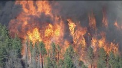
LARIMER COUNTY, Colo. (CBS4) – Crews are battling a large wildfire burning in the Paradise Park of Larimer County on Saturday.
At 4 p.m. the fire was estimated at 2,000 to 3,000 acres. New evacuations have been ordered for Stove Prairie Road north along County Road 27 to Highway 14, east along Highway 14 to approximately mile marker 111, southeast to Rist Canyon Fire Station 1, then back west to to include Wilderness Ridge Way, Rist Creek Road, Spring Valley Road and County Road 41 and all of the roads that run off of it. Officials said 227 notifications were sent out. An evacuation center has been set up at Cache La Poudre Middle School located at 3515 West Count Road 54G in Laporte.Highway14 has been closed at Stove Prairie Road. The fire is burning on both private and Forest Service land. The cause of the fire is unknown. The Larimer Humane Society is providing temporary shelters for dogs, cats, small mammals and small farm animals — the size of a goat or smaller — for individuals affected or displaced by the High Park Fire. Horses and cattle can be taken to the Ranch-way Feed building at The Ranch located directly adjacent to I-25, just north of Highway 34, in Loveland, Colorado. Evacuees requiring assistance for their pets are encouraged to contact 970-226-3647 ext. 7 to speak with an Animal Protection and Control dispatcher. Visit: the Larimer Humane Society website for more information. |
Castaic Fire Closes I-5 Freeway, Burns Over 500 Acres - June 2012 |
Northbound lanes of the 5 Freeway were shut down at Lake Hughes Road.
At 1:30 p.m., the blaze had charred 3 to 5 acres. By 3 p.m. the fire had increased to more than 50 acres. By 4:15 p.m. the fire had grown to 150 acres. By 5:45 p.m. the fire had grown to 500 acres. It was reportedly 10 percent contained. Fire officials said flames were running uphill and they were fighting it from the air. A total of six helicopters and three fixed-wing tankers were battling the blaze, along with 250 firefighters on the ground. No structures were threatened. No injuries were reported. The cause of the fire was not immediately known. |
Whitewater-Baldy Complex Fire Information - 5/29/12 Evening Update
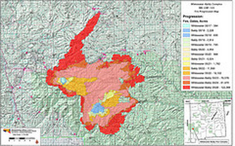
Fire Facts:
Date Started:05/16/2012 Number of Personnel:1,236 personnel including Location:Approximately 15 miles E of Glenwood, NM15 hotshot crews, 13 hand crews Cause:Lightning Equipment:58 Engines, 24 Water Tenders, 7 Dozers Size: 170,272 acres Aircraft:12 Helicopters Percent Contained: 0 Injuries to Date:Five
General Information:
For the most part, the fire has been actively burning in all directions. Near the northeast corner of the fire below the Middle Fork of the Gila River, there was significant movement to the east. The area around Willow Creek is looking secure and only a few smokes have been visible. All burnout operations around Mogollon are successfully creating a secure fire break around the community. The fire did spot into the Whitewater drainage on the west side of the fire but there are no immediate threats. The fire is still active to the south but is slowing backing down drainages.
Today’s Planned Activities:
Previous burnout operations on the north side of the fire along Forest Road 141 are cooling off and crews will begin mopping up any remaining hot spots. Crews will continue to burn vegetation from previous burnout operations to create a larger fire break around the fire’s edge. Structure protection will continue in Mogollon, Willow Creek and near other ranches and homes.
Closures/Advisories:
Forest Road 141 at the old sawmill
Forest Road 28 at Forest Road 94 junction (Collins Park)
State Route 159 at Whitewater Mesa
Forest Road 150 and Forest Road 142 junction (Beaverhead Work Center)
The Gila National Forest closed the Catwalk National Recreation Trail until further notice. Please visit the Gila National Forest Website at www.fs.usda.gov/gilafor further details on this closure.
Before a wildfire approaches your home, evacuate your pets and all family members who are not essential to preparing the home. Anyone with medical or physical limitations and the young and elderly should be evacuated immediately. Remember the “P’s of Evacuation”; People, Pets, Prescriptions, Papers, Pictures and Personal Computer.
Serious fire danger extends into the Sierra high country
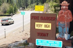
Fire danger already made destructively clear in the lower elevations is reaching high into the mountains, with experts predicting a potentially dangerous summer for Tahoe-Truckee and the Sierra. After years have passed without any major wildfires in the high country, a sub-par mountain snowpack and vegetation now as dry as normally seen much later in the year are combining to produce explosive conditions.
“As the fuels continue to dry, we’re very concerned with the potential for fire in the Tahoe Basin,” said Mike Brown, chief of the North Lake Tahoe Fire Protection District, which serves the Incline Village area. “We usually don’t experience these kinds of fuel moisture issues until July or August,” Brown said. “We’re seeing it way too early.”
The situation couldn’t be more different than last year, when an epic winter layered the mountains in deep snow that lasted well into the summer at high elevations. It kept vegetation moist and fire danger low. This year’s winter season produced only a little more than half the snow normally expected. The winter was not unlike the one of 2006-2007, when only 40 to 50 percent of the normal amount of snow fell in the Sierra.
It was on a windy afternoon in June of 2007 when sparks from an abandoned campfire ignited the wildfire long feared at Lake Tahoe. In a matter of hours, the Angora Fire destroyed 254 homes in the South Lake Tahoe area. A drier-than-normal winter also preceded the June 2001 Martis Fire, which blasted down the Truckee River Canyon, ultimately burning 14,500 acres and threatening to destroy the town of Floriston, Calif., west of Reno. As always, whether a bad fire burns this summer will depend on whether one starts at the wrong time, particularly on a windy day. But with dry conditions already established and long, hot months ahead, the risk is already there.
“It’s certainly going to be dry and we certainly have the potential for something big,” said Dave Zaski of the North Tahoe Fire Protection District, which serves Tahoe’s California-side communities of Tahoe City and Kings Beach. In Incline Village, fuel treatment work conducted for years would hopefully keep flames out of tree crowns – the worst kind of timber fire – if a fire starts, Brown said.Still, Brown said, “we have the potential for (a fire) to go catastrophic.” He urges residents to take steps to ensure they have adequate defensible space around their homes. Dry conditions have already shown their danger in the Reno area, which experienced rare winter-season wildfires in November and again in January, with nearly 30 homes destroyed each time. A similar pattern is emerging in the high-elevation terrain of Tahoe National Forest west of the Reno-Tahoe area, with 11 small fires burning over the winter. “We’ve probably had more fires this winter than we did all of last year. It’s a much different situation,” said Jeanne Pincha-Tulley, fire management officer for the U.S. Forest Service. The checkerboard of public-private land within the boundaries of Tahoe National Forest totals 1.6 million acres.
Dry conditions exist throughout the area and the situation is worsened by a large amount of brush on north-facing slopes apparently killed by frost over the winter, Pincha-Tulley said. Forecasts call for a summer monsoon season that could produce significant lightning as well, she said. “We’ve got to be very cautious,” Pincha-Tulley said, adding that it will be particularly important this summer for people to be careful with smoking, campfires or anything else that might spark a dangerous fire. “It’s time to be careful,” she said.
|
|
Arizona Wildfires 2012: Blaze Near Historic Mining Town Nearly Triples In SizeCROWN KING, Ariz. (AP) — Fueled by high winds, a wildfire that has prompted the evacuation of a historic mining town in northern Arizona nearly tripled in size.
The fire in the Prescott National Forest grew to an estimated 5,400 acres, or nearly 8 1/2 square miles, Wednesday night — up from about 2,000 acres a day earlier. High winds have helped fan the flames, and fire officials were expecting much of the same conditions for the next couple of days. Most of Crown King's 350 residents had already evacuated their homes before Taryn Denyce finally left earlier Wednesday, feeling she had no other choice. |
She didn't fear for her life, nor for the bed and breakfast she took over from her parents a few years ago that was being powered by a generator.
Instead, authorities mistakenly told her she could be arrested if she didn't leave, even if she was on her own property, Yavapai County sheriff's spokesman Dwight D'Evelyn said. When a sheriff's official showed up at her door in downtown Crown King and offered to help pack her truck, she reluctantly left.
"I felt I had no choice. I was raised a Catholic girl," said the 48-year-old retired nurse. "I follow the rules, and if he's telling me 'it's time to go Taryn,' it's time to go."
The winds were pushing the blaze away from the community of mostly summer homes about 85 miles north of Phoenix. But fire incident spokeswoman Michelle Fidler said winds could shift and push the fire back into the community where it started and possibly threaten some communications towers in the area.
Road access also is a concern. Fewer than 10 residents remain in their homes, D'Evelyn said, and they could become trapped if the flames cross or block access roads.
Firefighters also would be pulled out if that happens, Fidler said. Most of the 350 residents initially chose to stay in the town that's popular for all-terrain vehicles because of its numerous hills and gorges. But D'Evelyn said sheriff's officials persuaded about 20 of the 30 residents still left early Wednesday morning to go — including Denyce.
"Most people have come down from the hill," he said. "We want them all down. We don't want to have to worry about anyone who doesn't need to be up there."
The fire has destroyed two homes and a trailer, and prompted an evacuation order on Sunday. The fire started at an occupied home, but fire investigators have yet to determine the cause. It remained 5 percent contained Wednesday. Denyce gathered what she could from her home in 20 minutes and is now staying with a friend in Glendale. She said she would rather be protecting her property and trying to keep her business viable but now is prohibited from returning, as are other residents who have left. "I have my daughter and my animals and I'm just happy we're out, but I don't think I was in imminent danger," she said.
Smoke from a larger fire that began Saturday south of Payson drifted into Phoenix over the weekend. U.S. Forest Service officials said the 12,500-acre blaze was burning in the high wilderness area of the Tonto National Forest and was 10 percent contained. No structures were threatened.
Another wildfire in the Tonto National Forest northeast of Young was at about 1,900 acres Wednesday but 15 percent contained. That fire was believed to be lightning-caused and wasn't threatening any structures.
The fires follow a warning from Arizona land managers that hot temperatures and dry vegetation have created a very high fire risk in some parts of the state.
In northern Colorado, 200 firefighters were battling a 1,000-acre blaze that is 5 percent contained. Two groups of residents have been told to prepare for evacuations, but no one has had to leave. The fire was within a quarter-mile of some homes. The U.S. Forest Service says the fire was caused by humans. The investigation into how it started is continuing.
Hundreds evacuated as wildfires spread across northern Arizona
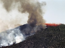
A fire in Crown King has forced 350 residents from their homes in a historic mining town just weeks ahead of the busy tourist season. There, the fire began on private land Sunday and has grown to 1,300 acres, destroying two buildings and one trailer, Prescott National Forest spokeswoman Debbie Maneely said.
The blaze started at a "structure" and was human-caused, she said. Crown King is a popular destination for all-terrain vehicles because of its numerous hills and gorges. It is located in the mountains more than 85 miles north of Phoenix.
As of Monday evening, the Crown King fire had not been contained.
A wildfire more than 120 miles northeast of Phoenix was five percent contained Tuesday evening, according to the Incident Information System. The 4,600-acre fire there – deemed very active – emanated dark plume smoke, according to the incident site. Authorities had not determined the cause of that fire Expected hot and windy weather could make containment difficult, Maneely said.
The role embers played in destroying homes in the Caughlin Fire - Reno, NV 2012
New Mexico establishes fire notification system.The state of New Mexico has established a system by which residents can be notified about wildfires. Emails will contain information including when the fire started, the cause, and a description of threatened homes and communities. For now, the system will send people who sign up for the service information about all fires within the state. Later it will be refined so that notifications can be filtered to more specific locations, such as counties. Anyone can sign up HERE. |
Acton Fire Destroys 3 Homes |
Dry Year Adds Urgency to Wildfire
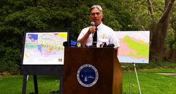
Dry Year Adds Urgency to Wildfire WarningsOfficials say low fuel moisture tied to below-normal rainfall means this could be a challenging fire season in Santa Barbara County
By Tom Bolton, Noozhawk Executive Editor | @tombol | Published on 05.02.20AM
The briefing for the news media, public officials and others was held at Manning Park in Montecito. Rainfall that was considerably less than normal this year means fuel moisture is well below where it typically is this time of year, and that portends potentially more intense fires. “The recent greening up (due to rains in March and April) is a good thing, but it’s not time to relax,” said Dave Gomberg, fire weather program manager for theNational Weather Service in Oxnard. He noted that sundowner winds, which can contribute to fierce firestorms, are prevalent in May and June, and return again in the fall. In many areas of the region, fuel moisture levels are around 75 percent, according to Mark vonTillow, battalion chief with the U.S. Forest Service in Los Padres National Forest. Fuel moisture becomes critical, he said, when levels drop to 60 percent, while normal for this time of year is about 110 percent. That point was driven home by Division Chief Dan Ardoin with the Vandenberg Air Force Base Fire Department. “From a fire-behavior point of view, it’s not whether we’re going to have fires, it’s what kind of fires we’re going to have when we do get them,” he said. Areas of potentially greatest concern include the front side of the Santa Ynez Mountains east of Cold Springs Creek, a region that has not burned since the 1964 Coyote Fire, according to Ardoin. A color-coded map of the area showed a conspicuous lack of any recent burns in that area, which is north and east of the terrain that burned in 2009’s Jesusita Fire. “The fuels there are heavy and over-mature; the shrubs are more dead than alive, increasing a fire’s intensity,” Ardoin said. He also noted the Burton Mesa area near Lompoc and Vandenberg, and Tepusquet Canyon east of Santa Maria as areas of concern because of large amounts of thick, dry vegetation. All three areas have many residences interspersed with the vegetation, he said, noting that access and “defensible space” are critical in providing protection during a wildfire Chief Andrew DiMizio of the Santa Barbara City Fire Department used the scenario of a fire breaking out at the city’s Parma Park to explain how local agencies use the “mutual aid” system to battle major wildfires. An initial response to a vegetation fire in the park, located on Stanwood Drive in the foothills above Santa Barbara, would include eight fire engines and 47 firefighters, DiMizio said. In the event such a blaze continued to escalate, resources would be brought in first from the region, then from the state and eventually from throughout the country. DiMizio said this mutual-aid system is critical to quick and effective response to major wildfire. “There’s nothing magical about this,” he said. “It’s a result from years and years of work, training and cooperation.” Geri Ventura, who coordinates public education programs for the Montecito Fire Protection District, closed the program by emphasizing that community resources are a critical component of responding to wildfires. She noted that at any given time, there are only 23 fire engines on duty on the South Coast, “The chance of a fire engine being in front of your house when there’s a wildfire are pretty slim,” she said. Community resources, including a variety of groups and hundreds of volunteers, can and do make a real difference when major wildfires occur, Ventura said. She also urged fire agencies not to overlook or dismiss the value of volunteers, especially those who have gone through training to become part of Community Emergency Response Teams (CERT). “It doesn’t take a ton of money to foster these groups,” Ventura said. “Volunteers are not paid. They work for free and for the betterment of society, not because they’re worthless, but because they’re priceless. — Noozhawk executive editor Tom Bolton can be reached at[email protected]. Follow Noozhawk on Twitter: @noozhawk,@NoozhawkNews and @NoozhawkBiz. Connect with Noozhawk on Facebook. |
Al Qaeda magazine encourages forest fire arson in the US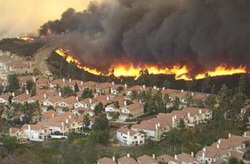
Al Qaeda magazine encourages forest fire arson in the US - By: Bill Gabbert Wildfire Examiner
A magazine published by members of al Qaeda has called for Western Muslims to wage war within the United States, urging them to engage in lone wolf attacks, including setting forest fires. According to ABC News, a recent issue of Inspire magazine has surfaced on jihadi forums with one article titled "It Is of Your Freedom to Ignite a Firebomb", which gives detailed instructions on how to build an "ember bomb" in a forest in the United States, and suggested Montana as a choice location due to the rapid population growth in forested areas. In America, there are more houses built in the [countryside] than in the cities. It is difficult to choose a better place [than] in the valleys of Montana. A previous issue of the magazine contained information on how to construct remote-controlled explosives, and helpfully listed the needed parts along with instructions and photos. ABC News has been calling around today to find a wildfire expert who can be interviewed on camera for a piece that will be on Monday's Good Morning America. One person they called was Dick Mangan, a past President of the International Association of Wildland Fire (IAWF), but ABC was not able to work out the logistics of quickly getting a camera crew to his house in Montana. Instaed, they were able to find Julie Hutchinson, a CAL FIRE Batallion Chief in the Sacramento area, who could get close to a camera. During the interview Chief Hutchinson said: It does not seem all that far fetched. A wildfire moves quite quickly and can inflict damage, and if people have that intent it's very frightening. ABC may have contacted Mangan because he wrote an article for the March/April 2005 issue of Wildfire, a magazine published by the IAWF, titled Terrorists in the Woods, about the potential for terrorists to set vegetation fires in wildland areas. In the article he mentioned that police and structural fire departments receive funding for the possibility of terror-related incidents, but the land management agencies receive little or nothing to plan for or prevent threats such as these. And since Mangan wrote that aricle, the budgets for the federal agencies that have wildland fire suppression responsibilities have been reduced and the number of air tankers have been cut from 44 in 2002 to 10 in 2012. Below is an excerpt from Mangan's 2005 article. ...The massive increases in the federal budget for protection from terrorism mostly have been sent to police and structural fire departments. But what about the threat of terrorist-caused wildland fires in our forests, community watersheds and wildland-urban interface? Who's worried about that threat, what are they doing about it, and how much is being spent to fund the efforts to prevent it? The history of fire as a tool of warfare is well-documented: Native Americans used fire against their enemies, both other tribes and the expanding Europeans; the Aboriginal people of Australia used fire to discourage the incursion of the British settlers onto their island. In World War II, the ]apanese launched "fire balloons" against the western United States. While largely unsuccessful, they started a few fires and killed six people in Oregon. The Palestinians in ihe latter half of the 20th century used fire to try to destroy Israel's carefully planted pine plantations. Now, as more and more folks are moving into the wildland-urban interface, the danger of fire as a weapon is even greater. Even under the best of circumstances - when a single ignition occurs under critical fire conditions - hundreds and thousands of citizens are threatened with entrapment, injury or death from rapidly spreading fires. Imagine if a small band of determined terrorists, with only some basic fire weather knowledge and fire behavior training decided to set multiple ignitions in some of our most vulnerable areas like heavily populated valley bottoms with limited egress/acceass and a heavy, dry fuel loading at the peak of the burning period? There are many such areas around the world: in the foothills of Andalusia in Spain; outside of Sydney and Melbourne, Australia, and in numerous areas of the United States from Florida to the Pine Barrens of New York to the foothills surrounding Los Angeles. Even my own hometown of Missoula, Montana has areas that fit all the above criteria, and is surely at risk under the wrong combination of weather conditions and a committed terrorist with fire on the brain. We contacted a spokesperson for the IAWF, Paula Nelson, about the reported threat of terrorist-arson, and she said: Wildfire threats and terrorist threats cross borders and require us all to be prepared and vigilant. Training and communicating with fellow firefighters, regardless of agency or country, is always worthwhile in improving our capabilities in both arenas. This is a cornerstone for the work IAWF does. If you'd like to protect your home from wildfire - Contact Consumer Fire Products, Inc. at 1-866-901-CFPI (2374) or Click HERE. Article By: Bill Gabbert - Bill Gabbert has been involved in wildland fire for over 30 years, having worked in suppression, prevention, prescribed fire, management, and with the International Association of Wildland Fire. He owns Sagacity Wildfire Services and manages the web site Wildfire Today. Email Bill. |
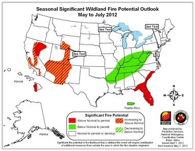
2012 Fire Season Outlook Western States
Posted: 15 Apr 2012 01:09 PM PDT
A state-by-state look at 2012 fire season prospects for the West:
ALASKA — Ample snowpack and anticipated cooler temperatures in the south means fire season likely will not start until the end of May, later than normal, according to the Northwest Interagency Coordination Center. Snowpack is near to above normal in northern Alaska — and well above normal in south central Alaska. Longer-range forecasts suggest that colder than normal conditions will prevail across southern Alaska, while the Gulf of Alaska coast will be drier than normal, the center says.
ARIZONA — Arizona had its worst fire in history in 2011, the Wallow Fire that charred more than 840 square miles in the state and parts of New Mexico. State officials say the strong winds that fanned the fire will be less of a factor this year. But an abundance of grass in southern Arizona and drought, some of it severe, means an active season. "I'm anticipating a more normal fire season with the caveat that there's still residual fuel from years past and, of course, there is still drought," said Cliff Pearberg of the Arizona State Forestry Division.
CALIFORNIA — Another active wildfire season for a state that has received little moisture this year and that in recent years has seen huge fires which destroyed hundreds of homes, especially in Southern California. Above-normal fire threats for June and July in mountain areas, the central coast and inland Southern California, according to Daniel Berlant of the California Department of Forestry and Fire Protection. While typical fire season runs from May through October, Southern California always is at risk. "Fire season is just about year-round now because we always have those Santa Ana winds that are always threatening," said Los Angeles County fire Inspector Quvondo Johnson.
COLORADO — Significant fire potential across eastern Colorado's plains, dry Rockies forests and the Western slope due to drought, low humidity and lack of precipitation. Snowpack is below normal and evaporating faster than usual. The National Weather Service has issued red flag fire warnings in many parts of the state on an almost routine basis since March 6. Multiple counties have enacted open-air fire bans.
IDAHO — Idaho expects a normal fire season — for now. The state's mountain ranges have normal snowpack, reservoirs are dumping water for snowmelt and early spring has brought more rain and snow, even in the desert-like south. Federal wildfire analyst Jeremy Sullens cautions early predictions can change with spring precipitation and the growth of grasses and plants that provide initial fuel for forest and rangeland fires.
HAWAII — Drought has produced an above-normal wildfire potential this season along the leeward, or western, sides of the Hawaiian islands, including the western third of the Big Island. Most of the Hawaii islands have received above normal precipitation this year, including the northern and western islands, the Northwest Interagency Coordination Center says.
MONTANA — State officials expect a normal 2012 after cool weather and spring floods all but eliminated the fire season last year. Mountain snowpack is at average levels and, barring a rapid warm-up, fire season is expected to run from July to September, said Bryan Henry, a meteorologist with the Northern Rockies Coordination Center. The state's plains are an exception. "A couple of dry, windy days, it will be ready to burn," Henry said.
NEW MEXICO — Fire officials are preparing for another rough year. Forecasters have been issuing fire weather watches as spring storms bring dry lightning and gusty winds to the state. More than 80 percent of the state is mired in drought, and Gov. Susana Martinez has warned 2012 could be a repeat of a destructive 2011. "What it boils right down to is the potential is still there," says Dan Ware of the State Forestry Division.
NEVADA — An early fire season expected after a late season in 2011 that blackened 665 square miles in 815 fires. A 93-year-old woman died in a January blaze that destroyed 29 homes and forced 10,000 people to evacuate their residences outside Reno. Drought affects virtually all of the state. "We're going to see an early fire season," state Forester Pete Anderson says. "It pretty much hasn't ended, frankly."
OREGON — The Northwest Interagency Coordination Center predicts a normal fire season for Oregon. A wet spring will delay the onset of fire season but not affect its severity. Temperatures are expected to be higher and humidity lower than in 2011, which saw a below average number of fires and acres burning. Large fires typically come from lightning strikes in remote locations. "We anticipate higher temperatures, meaning lower humidity, gradually increasing fire danger up to normal levels, maybe bit above normal, through the summer of 2012," said fire meteorologist John Saltenberger.
UTAH — Fire officials worry about large swaths of fuel, including waist-high grasses, left over from bountiful rains and snow in 2011. Already, farmers clearing land and fence lines have sparked numerous small fires. "We're hoping to get more moisture to green things up, but we have nowhere near the rain and snow we had last spring. Things are dry and it doesn't take much to get a fire going," says Jason Curry of the Utah Division of Forestry, Fire and State Lands.
WASHINGTON — The Northwest Interagency Fire Coordination Center expects a normal fire season this year in Washington, after four straight years with below-average acres burned. The 31 square miles burned in 2011 was far below the 10-year-average of 200 square miles, in part because major lightning bursts missed the state and ran to the south through Oregon.
WYOMING — Wildfire activity higher than normal with low snowpack in mountains. National Weather Service anticipates warm, dry summer; increased lightning storms can ignite dry grasses and forests, says State Forester Bill Crapser. "It really depends on what the weather does the next couple of months here," Crapser said.
Fire Command Center | WUI Maps | USFS Fire Management | Wildfire Discussions | CAL FIRE | Community Wildfire Plan | International Wildfire
©2010 Consumer Fire Products, Inc. All rights reserved.
©2010 Consumer Fire Products, Inc. All rights reserved.
